One-way walking distance
Duration
Level of Intensity
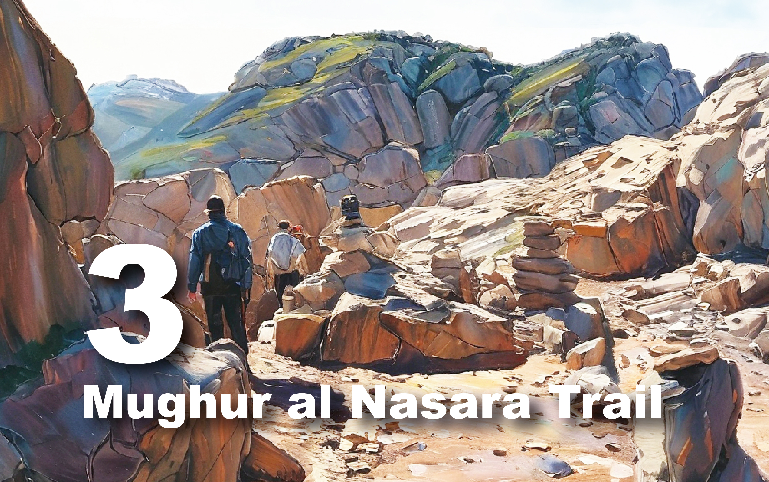
Ras Slaysil Trail
Explore
Ancient Landscapes and Scenic Vistas
The
Ras Slaysel Trail begins at the main road in Bayda, east of Kharrubat al-Fajja,
and concludes at Ras Slaysel. The trail heads west from Kharrubat al-Fajja and
extends for 4 kilometers. Initially, you’ll traverse a vast agricultural area
dotted with constructed retaining walls used for terracing and damming.
In
the Shamsa region, the trail intersects with the al-Dayr back trail and
continues westward to Wadi Slaysel. Here, you'll encounter many ancient
Nabataean farming terraces and several ruined sites. As you progress through
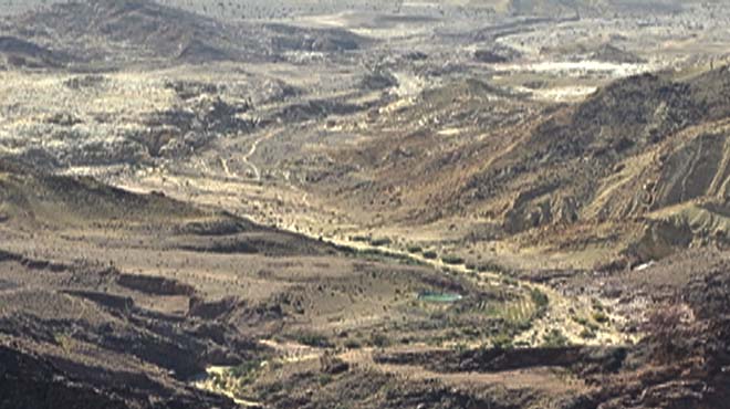
Wadi Slaysel, you’ll reach Ras Slaysel, where you can visit the Ras Slaysel
High Place. This spot provides a spectacular viewpoint overlooking Wadi Araba,
Wadi Marwan, Jabal Härun, and the Dayr plateau.
For
a safe and enjoyable hike, please bring plenty of drinking water, wear
comfortable shoes, and don a hat for sun protection. While enjoying the views
from Ras Slaysel, exercise caution and be mindful of sharp, rocky areas.
Trail
Details
Starting
Point: Bayda/Kharubat al Fajjah
Endpoint:
Bayda/Ras Slaysil
Category:
Heritage/Environmental/Geological
Distance:
4.3 Km/5643 Steps
Calories
Burn: 226 Calories
Duration:
1.30 - 1.45 Hours/Non-stop
Grade:
Easy
Tour:
One-way
The
Cultural Heritage Village al-Bayda
The
Cultural Heritage Village al-Bayda, a key part of Petra’s holistic conservation
strategy, offers a forward-thinking approach to sustainable tourism and
community development. Situated near Little Petra, this modern village,
recently developed by the Petra Development and Tourism Region Authority
(PDTRA), is designed to boost the local economy and preserve the area’s
cultural significance.
The
village features a main plaza and market, an open theatre, and an art center,
along with a heritage center and a culture and education center. Visitors can
enjoy traditional restaurants, outdoor cafes, and a variety of seasonal
activities. Additional amenities include a dedicated administration annex and
enhancements for waterway protection to ensure environmental sensitivity.
Crucially,
the village serves as a tourism hub that enriches the visitor experience while
easing pressure on Petra’s archaeological park. It provides valuable economic
opportunities for locals and a platform for showcasing traditional crafts and
cultural heritage. Overall, the village is a sustainable and culturally
immersive destination, promoting responsible tourism practices and preserving
the region’s natural and cultural resources for future generations.
Kharrubat
al-Fajja
Also
known as Sad al-Kharruba, meaning ‘carob dam’ in Arabic, Kharrubat al-Fajja is
a fascinating example of a small Nabataean dam. Situated across a gorge on a
high sandstone outcrop, the dam's original masonry wall featured three courses,
now missing, with visible rock cuts indicating where the rows were anchored.
The dam is named after a large carob tree ('kharruba' in Arabic) that once grew
within it. The Nabataeans used the dam for agricultural purposes in the Bayda
area, and it is possible that the Romans and Byzantines later utilized it
similarly.
Petra’s
unique location at the crossroads of three zoogeographic zones creates a
diverse range of landscapes and climatic conditions, supporting a variety of
flora and fauna. Historically, the area was home to four main indigenous tree
species: Kermes oak, Phoenician juniper, Mt. Atlas pistachio, and carob. Sadly,
three of these species are now listed as endangered. Petra also hosts rare
species such as the Petra Iris, Romulea of Petra, and the blue lizard of Petra.
Ruined
Structures at the Ras Slaysel Area
Journey
Through the Remarkable History of Ras Slaysel
The
Nabataeans, followed by the Romans, dedicated themselves to land reclamation
and agriculture in the Bayda region, particularly in Wadi and Ras Slaysel. They
built terraces for farming and cultivated the land with grains, vegetables, and
fruit trees, notably grapes. To manage water resources, they constructed
reservoirs and dams to collect rainwater. Rural houses were also established on
this land, as evidenced by the numerous ruined structures, including remnants
of terraced fields, water storage systems, and residential buildings,
showcasing their significant commitment to agriculture and livestock husbandry.
These
agricultural practices were essential for sustaining the local population and
economy, allowing a thriving community to develop in an otherwise arid
landscape. Today, the remains of their infrastructure—terraces, reservoirs, and
rural dwellings—are studied by archaeologists to understand the ingenuity and
resourcefulness of these ancient civilizations. Their legacy endures in the
landscape, continuing to inform our understanding of the region's agricultural
history.
The
Pond Temple
An
Ancient Nabataean Sanctuary
Nestled
450 meters below Räs Slaysil, the Pond Temple is a significant Nabataean site
at a crucial crossroads of ancient caravan routes. Based on the masonry,
architectural fragments, and pottery discovered outside the compound, it is
clear that this site was once a prominent temple complex. The name "Pond
Temple" is derived from the large pond at the foot of the precipice, which
was integral to the temple's function and location.
The
complex, located at Saheer al-Baqar, includes an array of structures such as
peristyles, stairs, and a Roman-style house with hypocausts, all ingeniously
adapted to the challenging terrain. A well-constructed road paved with durable
igneous stone leads from near Räs Slaysil down to the temple, indicating its
importance in connecting Petra with various regions, including the
Mediterranean and Syria.
The
Pond Temple was likely constructed due to its excellent water supply, with
water sourced from a spring and seasonal runoff. This sacred site reflects the
Nabataeans' reverence for water as a divine element. Despite its destruction,
possibly by an earthquake in the 3rd or 4th century AD, the Pond Temple remains
a testament to the Nabataeans' architectural and religious ingenuity.
The
area around the Pond Temple is lush with diverse plant life. Common vegetation
includes the willow (Salix acmophylla) and tamarisk (Tamarix species), thriving
in the wet, rocky environment. In the shaded, moist rocks, you can find the
maidenhair fern (Adiantum capillus-veneris), the sea dandelion (Sonchus
maritimus), and the water pimpernel (Samolus valerandi). On sunny slopes, hardy
shrubs and trees such as the fig (Ficus pseudosycomorus) and date palm (Phoenix
dactylifera) add to the site's natural beauty.
(Access
to the Pond Temple is prohibited from the upper point of Ras Slaysil due to
safety regulations)
Bir
Madhkur
A
Key Site on the Ancient Incense Route
Located
12 km northwest of Petra in the Wadi Araba foothills, Bir Madhkur is a
historically significant site on the Petra-Gaza trade route. Active during the
Nabataean, Roman, Byzantine, and Early Islamic periods, the site features a
prominent Late Roman/Early Byzantine fort, which may have been built over an
earlier Nabataean structure. Key highlights include this fort, a bath complex,
caravanserai, a civilian settlement, and surrounding cemeteries.
Bir
Madhkur was a vital caravan station on the famed Incense Route, linking Petra
with the Mediterranean port of Gaza. It served as a bustling hub where traders,
soldiers, and local communities interacted. The site’s rich history and
strategic location underscore its importance in ancient trade and cultural
exchanges.
Visitors
can arrange overnight stays in the area through licensed tour operators.
Additionally, a road connects the site to the main route between Aqaba, the
Dead Sea, and Amman, enhancing accessibility.