One-way walking distance
Duration
Level of Intensity
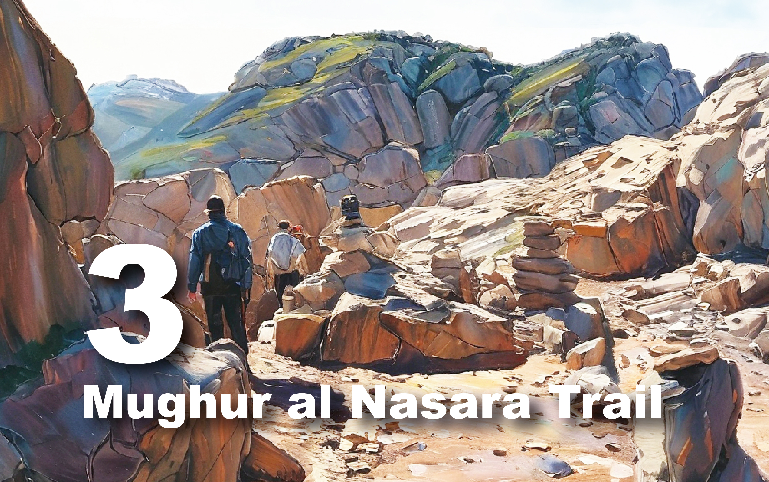
Umm Ratam Trail
Trail
overview
Enjoy
a breathtaking journey on the Umm Rattam Trail, stretching approximately 12 km
from Siq al-Barid to the Umm Rattam caravan station and Roman Gardens. This
scenic trail takes you through the Neolithic village of Al-Bayda, continuing
past Wadi Ghurab, Ras Slaysel, and Wadi Sahir al-Baqar. It starts in a large
agricultural area with terraced walls and dams. As you progress through Wadi
Slaysel, you'll encounter Ras Slaysel, renowned for its stunning views over
Wadi Araba, Wadi Marwan, Jabal Härun, and the Dayr plateau. The descent from
Ras Slaysel to the valley bottom is steep and challenging but offers impressive
vistas of lush, mountainous landscapes.
You
can choose to navigate the rugged Wadi al-Muzayri'a or take the northern route,
Al-Hammad, as indicated on the map. Afterwards, follow the Nabataean aqueduct
alongside the wadi until you reach the remarkable Umm Rattam caravan station
and Roman Gardens. Please check in with the Visitor Center beforehand for trail
details.
For
the best experience, start early in the morning to avoid the heat, bring plenty
of water, wear appropriate footwear, and pack some snacks.
Trail
Details
Starting
Point: Bayda/Siq al Barid
Endpoint:
Wadi Araba/Umm Ratam
Category:
Heritage/Environmental/Geological
Distance:
11.6 Km/15223 Steps
Calories
Burn: 609 Calories
Duration:
4.30 - 4.45 Hours/Non-stop
Grade:
Moderate/Difficult
Tour:
One-way
Siq
al-Barid, Bayda
Explore
Siq al-Barid: Petra’s Northern Gateway
Located
in Petra's northern suburb, Siq al-Barid served as a crucial resting place for
trade caravans traveling between southern Arabia and Gaza. Caravans would stop
here to rest, eat, and conduct business in the comfortable, shaded areas
provided.
Often
called ‘Little Petra,’ Siq al-Barid features a natural cleft in the rock,
similar to the main Siq but on a smaller scale, which forms the entrance to the
area. This gated complex includes a network of cisterns and dams, along with
dining halls and intricately carved facades. These amenities catered to the
needs of traders, with the cisterns providing essential water and Bayda being a
hub of agricultural production.
The
site also boasts several tricliniums or dining halls, which may have been used
for welcoming visitors and conducting ritual feasts. The practice of organized
feasting was well-documented by the ancient writer Strabo, who described how
the Nabataeans would host communal meals with musical entertainment.
Excavations have uncovered pottery statues representing musicians, which likely
replicate the performances at these feasts and provide insight into the
instruments used at the time.
Bayda
Neolithic Village
Step
Back in Time at Bayda Neolithic Village
Located
just 7 kilometers north of the Petra Visitor Center, Bayda Neolithic Village is
one of Jordan's oldest settlements, dating back to the early Neolithic Period
(8500–5500 B.C.). The site was meticulously excavated by D. Kirkbride from the
British School of Archaeology in Jerusalem over seven seasons between 1957 and
1968, with a final season in 1983.
During
the 10th to 9th millennia BC, the Natufian people established a seasonal camp
at Bayda, using locally sourced flint for their weapons and tools. The site
reveals significant architectural development through six distinct phases. Early
structures included circular houses with stone walls and a central wooden post
supporting a roof made of wood, reeds, and clay. These early homes still show
visible postholes and grooves. Later, rectangular houses with plastered
interiors emerged, reflecting advances in construction techniques.
Nearby,
a small area features basins, standing stones, and paved enclosures, believed
to have served as a sanctuary. The inhabitants of Bayda engaged in hunting,
gathering wild plants, and also cultivating barley and wheat while keeping
goats and sheep.
Explore
Bayda Neolithic Village to uncover the rich history and evolution of one of the
region's earliest communities.
The
Pond Temple
An
Ancient Nabataean Sanctuary
Nestled
450 meters below Räs Slaysil, the Pond Temple is a significant Nabataean site
at a crucial crossroads of ancient caravan routes. Based on the masonry,
architectural fragments, and pottery discovered outside the compound, it is
clear that this site was once a prominent temple complex. The name "Pond
Temple" is derived from the large pond at the foot of the precipice, which
was integral to the temple's function and location.
The
complex, located at Saheer al-Baqar, includes an array of structures such as
peristyles, stairs, and a Roman-style house with hypocausts, all ingeniously
adapted to the challenging terrain. A well-constructed road paved with durable
igneous stone leads from near Räs Slaysil down to the temple, indicating its
importance in connecting Petra with various regions, including the
Mediterranean and Syria.
The
Pond Temple was likely constructed due to its excellent water supply, with
water sourced from a spring and seasonal runoff. This sacred site reflects the
Nabataeans' reverence for water as a divine element. Despite its destruction,
possibly by an earthquake in the 3rd or 4th century AD, the Pond Temple remains
a testament to the Nabataeans' architectural and religious ingenuity.
The
area around the Pond Temple is lush with diverse plant life. Common vegetation
includes the willow (Salix acmophylla) and tamarisk (Tamarix species), thriving
in the wet, rocky environment. In the shaded, moist rocks, you can find the
maidenhair fern (Adiantum capillus-veneris), the sea dandelion (Sonchus
maritimus), and the water pimpernel (Samolus valerandi). On sunny slopes, hardy
shrubs and trees such as the fig (Ficus pseudosycomorus) and date palm (Phoenix
dactylifera) add to the site's natural beauty.
Qubur
Iyal `Awwad
Qubur
Iyal `Awwad, located east of Qasr Umm Rattām in Wadi Araba, is a significant
ancient cemetery. Known locally as Maqām Qubur (Rjūd) Iyal `Awwad or Maqbarat
Dar Umm Dayeh, this large cemetery sits on a flat hill. Most graves are marked
by oval stone linings oriented east-west, with upright boulders at the head and
foot of each grave. Noteworthy are three circular stone cairns adorned with
wooden sticks and pieces of cloth, suggesting ancestor veneration.
Local
Bedouins believe that the cemetery contains the graves of devout Ammarin tribe
members buried long ago. Visitors come to seek blessings and spiritual
connection.
The
site features undressed brown and white limestone, along with chert and
sandstone boulders, arranged in irregular circles without mortar. Ashy spots,
traces of burnt incense, and stone platforms resembling altars in front of some
graves indicate ongoing ritual practices.
The
Caravan Station at Umm Rattam
The
Caravan Station at Umm Rattam, dating from the Nabataean period and later
reused in the Roman era, is strategically located on a platform between two
branches of the Wadi Musa Brook. The site features a prominent square tower
standing 13 meters tall and a large water reservoir on the northern side,
measuring 14.5 by 13.5 meters. This reservoir is fed by a 9.3 km long aqueduct,
which channels water from Ayn as-Siyyagh in Petra to Umm Rattam, ensuring a
reliable water supply for the station and the surrounding agricultural
terraces. The aqueduct highlights advanced Nabataean engineering in water
management. The caravan station itself is built from well-cut ashlars of hard
sandstone, likely sourced from the southern region. The reservoir includes
steps in the northeast corner, indicating a depth of at least 2.35 meters and a
capacity of around 330 cubic meters. This fortified complex, along with the
adjacent Roman Gardens terraced area, illustrates the strategic and
agricultural significance of Umm Rattam from the Nabataean to the Roman
periods.
Bir
Madhkur
A
Key Site on the Ancient Incense Route
Located
12 km northwest of Petra in the Wadi Araba foothills, Bir Madhkur is a
historically significant site on the Petra-Gaza trade route. Active during the
Nabataean, Roman, Byzantine, and Early Islamic periods, the site features a
prominent Late Roman/Early Byzantine fort, which may have been built over an
earlier Nabataean structure. Key highlights include this fort, a bath complex,
caravanserai, a civilian settlement, and surrounding cemeteries.
Bir
Madhkur was a vital caravan station on the famed Incense Route, linking Petra
with the Mediterranean port of Gaza. It served as a bustling hub where traders,
soldiers, and local communities interacted. The site’s rich history and
strategic location underscore its importance in ancient trade and cultural
exchanges.
Visitors
can arrange overnight stays in the area through licensed tour operators.
Additionally, a road connects the site to the main route between Aqaba, the
Dead Sea, and Amman, enhancing accessibility.