One-way walking distance
Duration
Level of Intensity
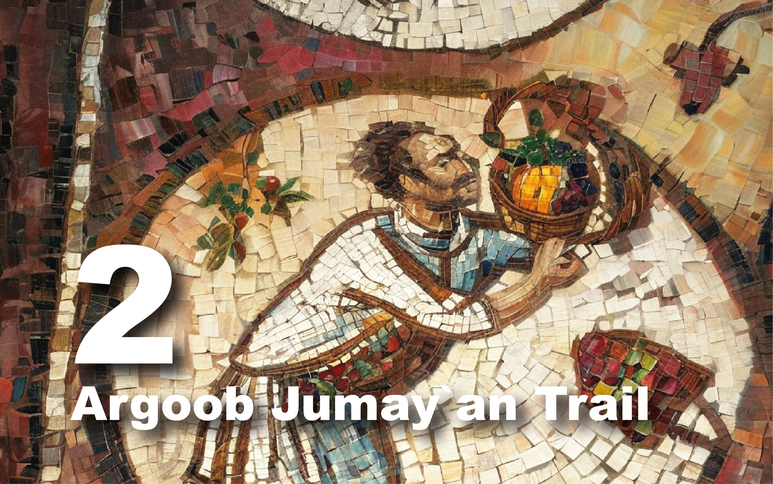
Al Mataha Trail
Trail
overview
Explore
the Al Mataha Trail, one of Petra's most scenic routes that leads from the
road's left side until reaching the Urn Tomb, but the first part requires
caution due to the sloped terrain. The route is a fascinating exploration of
archaeological monuments and water installations, including a 7-meter-long
arched bridge over Sha’ab Qais, part of an aqueduct that transported water from
Zurrabah reservoir to Palace Tomb. Sadd al'Ma'jan's slot canyon, with numerous
cultic niches, is considered a large sanctuary due to its former religious
significance to Nabataeans. Walking towards royal tombs, you'll see Sadd
al'Ma'jan, an ancient dam. The House of Dorotheus, a wealthy family house, is
named after an inscription. An aqueduct is carved from rock above the house.
After leaving Dorotheus, you'll see the Carmine façade and the Roman Governor’s
Tomb. The final destination is the Royal Tombs on Khubtha Mountain's western
side, including the Palace Tomb, Corinthian Tomb, Silk Tomb, and Urn Tomb.
Trail
Details
Starting
Point: Wadi Musa/Umm Sayhun//Main road/Urf al Deek
Endpoint:
Petra/Urn Tomb
Category:
Heritage/Environmental/Geological
Distance:
2.9 Km/3806 Steps
Calories
Burn: 152 Calories
Duration:
1.30 - 1.45 Hours/Non-stop
Grade:
Easy/Moderate
Tour:
One-way
The
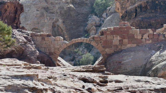
Arched Bridge Over Sha`ab Qais
This
arched bridge was a part of an aqueduct that supplied water to a large cistern
next to the Palace monument from the Zurrabah water reservoir, which is close
to the Petra Museum. The aqueduct is part of the highly sophisticated spring
water supply system that covers the entire city basin, bringing spring water
from the east, south, and north into the city via locally manufactured
terracotta pipes. This system provided the daily drinking water needs of Petra.
The arch has a span of 7 meters, and the top of the bridge reaches 20 meters
above the bottom of Wadi Sha`ab Qais. It is the only preserved arched bridge in
Petra’s entire city area. The construction of the Wadi Sha`ab Qais bridge
demonstrates their extensive expertise and water management skills. The bridge
was most likely built in the mid-first century BC. The Nabataeans were masters
of water management, inventing various water engineering techniques to supply
their city, Petra, which reached its peak of prosperity in the first century BC
and AD. visible at the Nasara Necropolis.
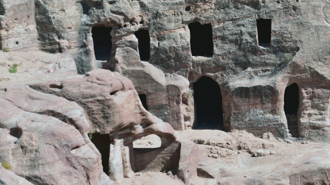
House
of Dorotheus
Although
it is known as the House of Dorotheus, it is actually a network of chambers
linked together to form a residential complex. It was most likely owned by a
large, wealthy family and was named after an inscription found on one of the
interior walls that mentioned Dorotheus. The complex is made up of roughly 20
interconnected rooms. It is also notable for having several front terraces and
small vegetable gardens that would have met the needs of the family who lived
there. There is an ancient aqueduct carved into the rock that passes above the
housing complex and can still be seen today. The aqueduct carried water from
the Zurrabah water reservoir (which is today located near the Petra archaeological
park building) to a cistern beside the Palace Tomb. It probably also served the
needs of the family living in this complex, including irrigating the gardens,
drinking, and household use. The presence of the house and aqueduct highlights
the advanced engineering skills of the inhabitants and their ability to utilize
natural resources effectively.
The
Carmine Façade
The
"Carmine" facade, named for its striking crimson hue, bears
resemblance to the striated facade of the Silk Tomb due to the diverse minerals
in the rock. The function of the structure is unclear, and the façade was not
completed. There is no entrance or carved interior, and the pilasters have no
bases. The Doric frieze that decorates it, as well as the pilaster capitals,
are similar to those found in the monastery. The carmine façade was never
completed, though the reason is unknown. It could have been due to a lack of
funds, a dispute with the builders, or that it was being built during the Roman
occupation, which may have halted work that was never resumed. The façade is
estimated to date to the 1st century AD and the beginning of the 2nd century
AD. Despite its unfinished appearance, the Carmine façade still stands as a
testament to the architectural skills of its builders. It is severely eroded,
and the natural deterioration must have been accelerated by excess water
overflowing from the water channel that runs above the monument.
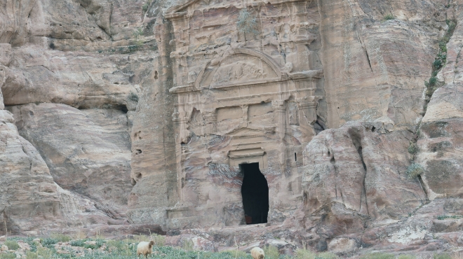
The
Tomb of Sextius Florentinus
After
Petra was annexed by the Roman Empire around the turn of the second century AD,
Nabataean life in the city generally went on as usual. The tomb of Sextius
Florentinus was built during Petra’s Roman period. It was named after the Roman
Governor of the Province of Arabia, who was in office at the time of Hadrian in
AD 127. A Latin dedication inscription above the doorway reveals that the tomb
was built by the son of Sextius Florentinus, the Roman governor of Arabia, in
accordance with his father's will. The façade's design combines Nabataean and
Roman elements, demonstrating the impact of time on the city and its
architecture. A carved head of a fertility goddess can be seen on the segmented
pediment, which is crowned by an eroded eagle. In the interior, five deep tomb
shafts (loculi) have been carved into the back wall, as well as three larger
burial chambers on the right side. A niche in the rear wall was carved to hold
idols.
The
Palace Monument
The
Palace monument is one of the most prominent monuments in Petra, sculpted out
of the western slope of the Jabal al-Hubta rock massif, overlooking the city
center. It is so named because its exterior is believed to resemble the façade
of a palace from the Roman era, hence its name. This monument is a grandiose
five-story façade (49 m wide and approx. 46 m high). Five doors on the first
lower level are crowned with triangular or semi-circular gables and framed by
engaged columns. Four internal chambers are accessible through the doors. A
narrow passage connects the two central ones. On the second level, there are 18
columns that support the third storey, which was partially built with ashlar
blocks. The fourth and fifth storeys are adorned with short pilasters and are
partially damaged by erosion. A dam and a water reservoir behind the monument
drain rainwater to a pool cut to the north of the monument podium. The monument
was probably used for banqueting or funerary ceremonies. The Palace Tomb was
probably built toward the end of the first century AD, or the early 2nd century
AD.
Corinthian
Tomb
When
Leon de Laborde visited Petra in 1828, he named it the Corinthian Tomb because
of its Greek Corinthian-style capitals on its upper story, closely resembling
those of the Khazna.
Its
heavily weathered facade, measuring 27.55 meters wide by 28 meters high,
consists of three levels. The lowest level is structured by eight half-columns.
The middle level, especially on the left side, is also heavily eroded. It
includes eight dwarf pilasters aligned with the level below. The upper level,
featuring six columns, strongly resembles the Khazna. Despite its weathered
condition, the intricate details and similarities to other well-known
structures suggest a high level of craftsmanship and design. The facade is
believed to have been constructed in the 1st century AD and is thought to have
been part of a larger complex. Inside, there are four chambers. The three on
the left are nearly square and without ornamentation. The primary chamber,
larger in size, contains three spacious recesses in the back wall, while the
right side wall hosts four recesses of varying sizes, including a loculus.
Traces of four water basins are visible in front of the tomb.
The
Silk Tomb
The
Silk Tomb, or streaked tomb, named for the rich colors of its facade resembling
an iridescent piece of silk draped on the rock, is one of the Royal Tombs
renowned for its striking façade, characterized by swirls of differently
colored rock and adorned with horizontal stripes of red, pink, white, brown,
black, yellow, and orange. The width of the façade spans 10.8 meters, and its
height reaches 19 meters. The monument is probably dated to the first half of
the 1st century AD. Immediately on either side of the façade, there are
chambers. Within the façade itself, the loculus is carved high up, flanked by
two pilasters on each side of the rock face. These loculi were usually used to
hold deceased individuals in ancient Nabataean times. The pilasters served as
decorative elements to enhance the overall appearance of the façade.
The
Urn Tomb
Similar
to its adjacent tombs, this graceful monument is carved deeply into the cliff
face at the foot of the Khubtha Ridge, and it is most likely dated to the first
half of the first century AD.
This
tomb derives its name from the jar that crowns the pediment. It is also
sometimes called "the Court" or "Al Mahkama" by the Bedouin
community, which thought the underground vaults served as prisons and the
building served as a courthouse. It is actually a Nabataean tomb. The tall
façade is decorated with engaged columns between pilasters. It has three
niches: the central one is close by a human bust. From the courtyard, two
doorways open onto an interior large hall (18.95 x 17.15 m), which was
remodeled with the carving of three apses. A Greek Byzantine inscription
records that the hall, which was originally a royal tomb, was converted into a
church by Bishop Jason in AD 447. A monumental stairway built over vaults gave
easy access to the church.